
Google Earth Engine ——非洲参考蒸发量(RET_E)数据集FAO/WAPOR/2/L1_RET_E
Reference evapotranspiration (RET) is defined as the evapotranspiration from a hypothetical reference crop and it simulates the behaviour of a well-watered grass surface. Each pixel represents the da....

Google Earth Engine ——全球资源管理系统火灾信息(FIRMS)1公里数据集
The Earth Engine version of the Fire Information for Resource Management System (FIRMS) dataset contains the LANCE fire detection product in rasterized form. The near real-time (NRT) active fire loca....

Google Earth Engine ——FORMA是一个基于MODIS的湿润热带森林的毁林警报系统数据集
FORMA is a MODIS-based deforestation alerting system for the humid tropical forests. FORMA is designed for quick identification of new areas of tree cover loss. The system analyzes data gathered dail....

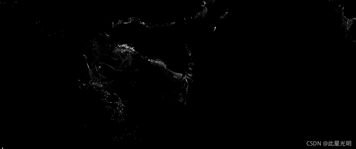
Google Earth Engine ——逐小时捕鱼强度GFW/GFF/V1/fishing_hours数据集
Fishing effort, measured in hours of inferred fishing activity. Each asset is the effort for a given flag state and day, with one band for the fishing activity of each gear type.See sample Earth Engi....
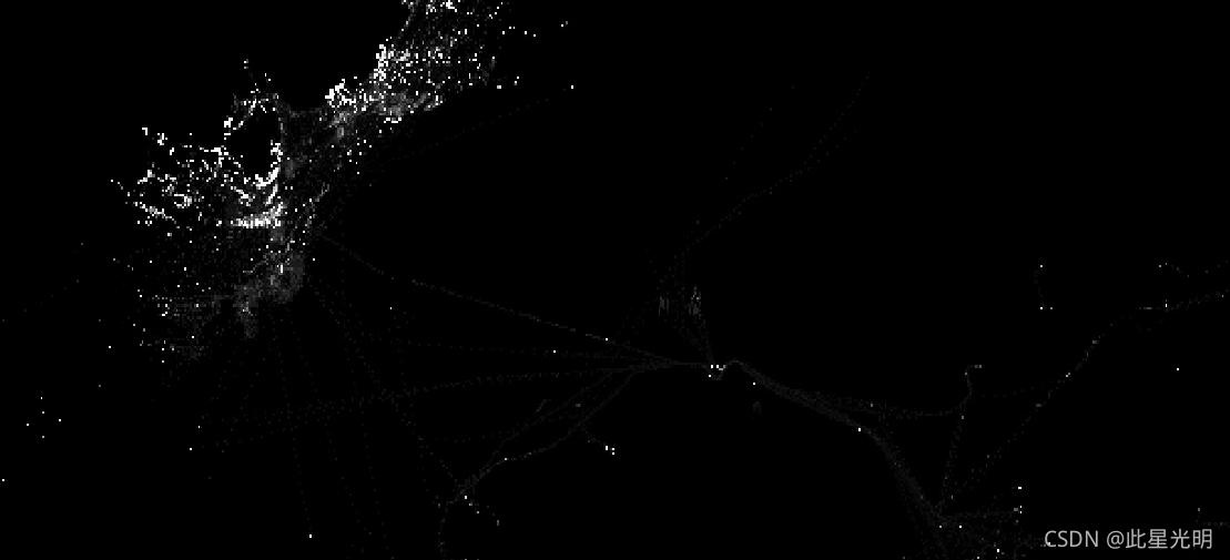
Google Earth Engine ——全球渔船信息GFW/GFF/V1/vessel_hours数据集
Fishing vessel presence, measured in hours per square km. Each asset is the vessel presence for a given flag state and day, with one band for the presence of each gear type.See sample Earth Engine sc....
Google Earth Engine ——非洲植被冠层的实际蒸腾量数据集FAO/WAPOR/2/L1_T_D
The transpiration (T) data component (dekadal, in mm/day) is the actual transpiration of the vegetation canopy. The value of each pixel represents the average daily actual transpiration for that spec....

Google Earth Engine ——MODIS Fire_cci焚烧区像素产品5.1版数据集
The MODIS Fire_cci Burned Area pixel product version 5.1 (FireCCI51) is a monthly global ~250m spatial resolution dataset containing information on burned area as well as ancillary data. It is based ....

Google Earth Engine ——数据全解析专辑(COPERNICUS/S5P/NRTI/L3_CO)实时的 CO 浓度高分辨率图像数据集
NRTI/L3_COThis dataset provides near real-time high-resolution imagery of CO concentrations.Carbon monoxide (CO) is an important atmospheric trace gas for understanding tropospheric chemistry. In cer....
Google Earth Engine ——数据全解析专辑(COPERNICUS/S5P/NRTI/L3_AER_AI)紫外线气溶胶指数 (UVAI) 的近实时高分辨率数据集
NRTI/L3_AER_AI This dataset provides near real-time high-resolution imagery of the UV Aerosol Index (UVAI), also called the Absorbing Aerosol Index (AAI).The AAI is based on wavelength-dependent....

Google Earth Engine ——数据全解析专辑(COPERNICUS/S5P/NRTI/L3_NO2) NO2 浓度的离线高分辨率图像数据集
OFFL/L3_NO2 This dataset provides offline high-resolution imagery of NO2 concentrations.Nitrogen oxides (NO2 and NO) are important trace gases in the Earth’s atmosphere, present in both the trop....

本页面内关键词为智能算法引擎基于机器学习所生成,如有任何问题,可在页面下方点击"联系我们"与我们沟通。
google更多数据集相关
- google森林数据集
- google时间序列数据集
- google烧伤数据集
- google modis数据集
- google图像数据集
- google earth modis数据集
- google空间数据集
- google earth engine尺度数据集
- google dsm数据集
- google 10m数据集
- google分辨率数据集
- google landsat数据集
- google网格数据集
- google global数据集
- google植被数据集
- google土壤数据集
- google engine植被数据集
- google非洲数据集
- google数据集气候
- google landsat指数数据集
- google ndvi数据集
- google engine数据集观测
- google指数数据集
- google影像数据集
- google公里数据集
- google表面数据集
- google火灾数据集
- google大气数据集
- google年际数据集
- google数据集观测
google您可能感兴趣
- google多模态
- google轻量
- google文本
- google任务
- google语言
- google图像
- google开源
- google gemma
- google模型
- google pro
- google engine
- google earth
- google gee
- google数据
- google play
- google分辨率
- google chrome
- google应用
- google解析
- google搜索
- google影像
- google ai
- google浏览器
- google分析
- google谷歌
- google网站
- google guava
- google地图
- google landsat
- google产品