
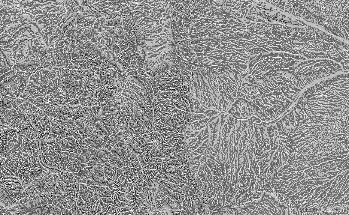
Google Earth Engine ——数据全解析专辑(US NED CHILI /Landforms/Topographic Diversity)美国DEM地形10米分辨率数据集
本次介绍三个数据集: CHILICHILI is a surrogate for effects of insolation and topographic shading on evapotranspiration represented by calculating insolation at early afternoon, sun altitude equivalent to equin....

Google Earth Engine ——数据全解析专辑(US NED mTPI (生态相关地貌(ERGo)270m分辨率数据集)
The mTPI distinguishes ridge from valley forms. It is calculated using elevation data for each location subtracted by the mean elevation within a neighborhood. mTPI uses moving windows of radius (km)....

Google Earth Engine ——数据全解析专辑(US NED Physiographic Diversity地貌多样性数据集)
The Physiographic Diversity dataset provides an index of the diversity of physiographic types. It was calculated using the Shannon diversity index at multiple-scales (km): 115.8, 89.9, 35.5, 13.1, 5.....

Google Earth Engine ——数据全解析专辑(US NED Physiographic Diversity地貌数据集代表地貌和岩性数据集)
The Physiography dataset represents the spatial intersection of landforms (available in EE as ERGo/1_0/US/landforms) and lithology (available in EE as ERGo/1_0/US/lithology) data layers. It provides ....
Google Earth Engine ——数据全解析专辑(US NED Topographic Diversity地貌多样性拓扑数据集)
Topographic diversity (D) is a surrogate variable that represents the variety of temperature and moisture conditions available to species as local habitats. It expresses the logic that a higher varie....

Google Earth Engine ——非洲土壤蒸发和截流(ETIa)数据集
The actual evapotranspiration and interception (ETIa) (dekadal, in mm/day) is the sum of the soil evaporation (E), canopy transpiration (T), and evaporation from rainfall intercepted by leaves (I). T....

Google Earth Engine ——非洲土壤表面的实际蒸发量数据集
The evaporation (E) data component (dekadal, in mm/day) is the actual evaporation of the soil surface. The value of each pixel represents the average daily actual evaporation for that specific dekad.....

Google Earth Engine ——非洲植被冠层拦截的降雨的蒸发量数据集
The interception (I) data component (dekadal, in mm/day) represents the evaporation of intercepted rainfall from the vegetation canopy. Interception is the process where rainfall is captured by the l....
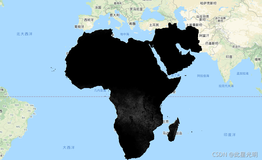
Google Earth Engine ——非洲净初级生产量(NPP)数据集FAO/WAPOR/2/L1_NPP_D
Net primary production (NPP) is a fundamental characteristic of an ecosystem, expressing the conversion of carbon dioxide into biomass driven by photosynthesis. The pixel value represents the mean da....

Google Earth Engine ——非洲参考蒸发量(RET)数据集FAO/WAPOR/2/L1_RET_D
Reference evapotranspiration (RET) is defined as the evapotranspiration from a hypothetical reference crop and it simulates the behaviour of a well-watered grass surface. The value of each pixel repr....

本页面内关键词为智能算法引擎基于机器学习所生成,如有任何问题,可在页面下方点击"联系我们"与我们沟通。
google更多数据集相关
- google森林数据集
- google时间序列数据集
- google烧伤数据集
- google modis数据集
- google图像数据集
- google earth modis数据集
- google空间数据集
- google earth engine尺度数据集
- google dsm数据集
- google 10m数据集
- google分辨率数据集
- google landsat数据集
- google网格数据集
- google global数据集
- google植被数据集
- google土壤数据集
- google engine植被数据集
- google非洲数据集
- google数据集气候
- google landsat指数数据集
- google ndvi数据集
- google engine数据集观测
- google指数数据集
- google影像数据集
- google公里数据集
- google表面数据集
- google火灾数据集
- google大气数据集
- google年际数据集
- google数据集观测
google您可能感兴趣
- google多模态
- google轻量
- google文本
- google任务
- google语言
- google图像
- google开源
- google gemma
- google模型
- google pro
- google engine
- google earth
- google gee
- google数据
- google play
- google分辨率
- google chrome
- google应用
- google解析
- google搜索
- google影像
- google ai
- google浏览器
- google分析
- google谷歌
- google网站
- google guava
- google地图
- google landsat
- google产品