
Google Earth Engine ——全球行政单位层(GAUL)国家层面数据集
The Global Administrative Unit Layers (GAUL) compiles and disseminates the best available information on administrative units for all the countries in the world, providing a contribution to the stand....

Google Earth Engine ——基于ENVISAT的中分辨率成像光谱仪全球土地覆盖300米分辨率数据集
GlobCover 2009 is a global land cover map based on ENVISAT's Medium Resolution Imaging Spectrometer (MERIS) Level 1B data acquired in full resolution mode with a spatial resolution of approximately 3....

Google Earth Engine ——Landsat 7 ETM+传感器的大气校正表面反射率数据集
This dataset is the atmospherically corrected surface reflectance from the Landsat 7 ETM+ sensor. These images contain 4 visible and near-infrared (VNIR) bands and 2 short-wave infrared (SWIR) bands ....

Google Earth Engine ——LANDSAT/LC08/C01/T1_TOA数据集
Landsat 8 Collection 1 Tier 1校准的大气层顶部(TOA)反射率。校准系数从图像元数据中提取。关于TOA计算的细节,见Chander等人(2009)。Landsat 8 Collection 1 Tier 1 calibrated top-of-atmosphere (TOA) reflectance. Calibration coefficients are extr....

Google Earth Engine ——2001-2017年非洲土壤深度 0-20 厘米和 20-50 厘米的可提取总碳,预测平均值和标准偏差数据集
Total carbon at soil depths of 0-20 cm and 20-50 cm, predicted mean and standard deviation.Pixel values must be back-transformed with exp(x/10)-1.In areas of dense jungle (generally over central Afri....

Google Earth Engine ——MACAv2-METDATA 数据集涵盖美国本土的 20 个全球气候模型的集合
The MACAv2-METDATA dataset is a collection of 20 global climate models covering the conterminous USA. The Multivariate Adaptive Constructed Analogs (MACA) method is a statistical downscaling method w....

Google Earth Engine ——MACAv2-METDATA 月度数据集涵盖美国本土的 20 个全球气候模型(GCM) 的集合1900-2099年
MACAv2-METDATA Monthly Summaries: University of Idaho, Multivariate Adaptive Constructed Analogs Applied to Global Climate ModelsThe MACAv2-METDATA dataset is a collection of 20 global climate models....

Google Earth Engine ——2001-2017年非洲土壤深度为 0-20 厘米和 20-50 厘米时的体积密度 <2 毫米分数,预测平均值和标准偏差数据集
Bulk density, <2mm fraction at soil depths of 0-20 cm and 20-50 cm, predicted mean and standard deviation.Pixel values must be back-transformed with x/100.In areas of dense jungle (generally over ....

Google Earth Engine ——2001-2017年非洲0-200 厘米深度的基岩深度,预测平均值和标准偏差数据集
iSDAsoil Depth to BedrockDepth to bedrock at 0-200 cm depth, predicted mean and standard deviation.Due to the potential cropland mask that was used for generating the data, many areas of exposed rock....

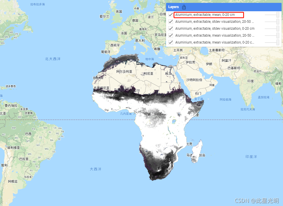
Google Earth Engine ——2001-2017年非洲土壤地表0-20 厘米和 20-50 厘米土壤深度处的可提取铝,预测平均值和标准偏差数据集
iSDAsoil extractable AluminiumExtractable aluminium at soil depths of 0-20 cm and 20-50 cm, predicted mean and standard deviation.Pixel values must be back-transformed with exp(x/10)-1.Soil property ....
本页面内关键词为智能算法引擎基于机器学习所生成,如有任何问题,可在页面下方点击"联系我们"与我们沟通。
google更多数据集相关
- google森林数据集
- google时间序列数据集
- google烧伤数据集
- google modis数据集
- google图像数据集
- google earth modis数据集
- google空间数据集
- google earth engine尺度数据集
- google dsm数据集
- google 10m数据集
- google分辨率数据集
- google landsat数据集
- google网格数据集
- google global数据集
- google植被数据集
- google土壤数据集
- google engine植被数据集
- google非洲数据集
- google数据集气候
- google landsat指数数据集
- google ndvi数据集
- google engine数据集观测
- google指数数据集
- google影像数据集
- google公里数据集
- google表面数据集
- google火灾数据集
- google大气数据集
- google年际数据集
- google数据集观测
google您可能感兴趣
- google多模态
- google轻量
- google文本
- google任务
- google语言
- google图像
- google开源
- google gemma
- google模型
- google pro
- google engine
- google earth
- google gee
- google数据
- google play
- google分辨率
- google chrome
- google应用
- google解析
- google搜索
- google影像
- google ai
- google浏览器
- google分析
- google谷歌
- google网站
- google guava
- google地图
- google landsat
- google产品