
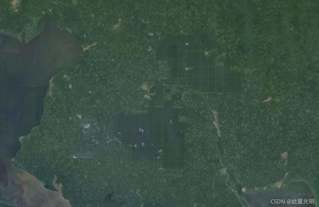
Google Earth Engine ——数据全解析专辑(Global Map of Oil Palm Plantations)全球油棕种植园数据集!
The dataset is a 10m global industrial and smallholder oil palm map for 2019. It covers areas where oil palm plantations were detected. The classified images are the output of a convolutional neural ....
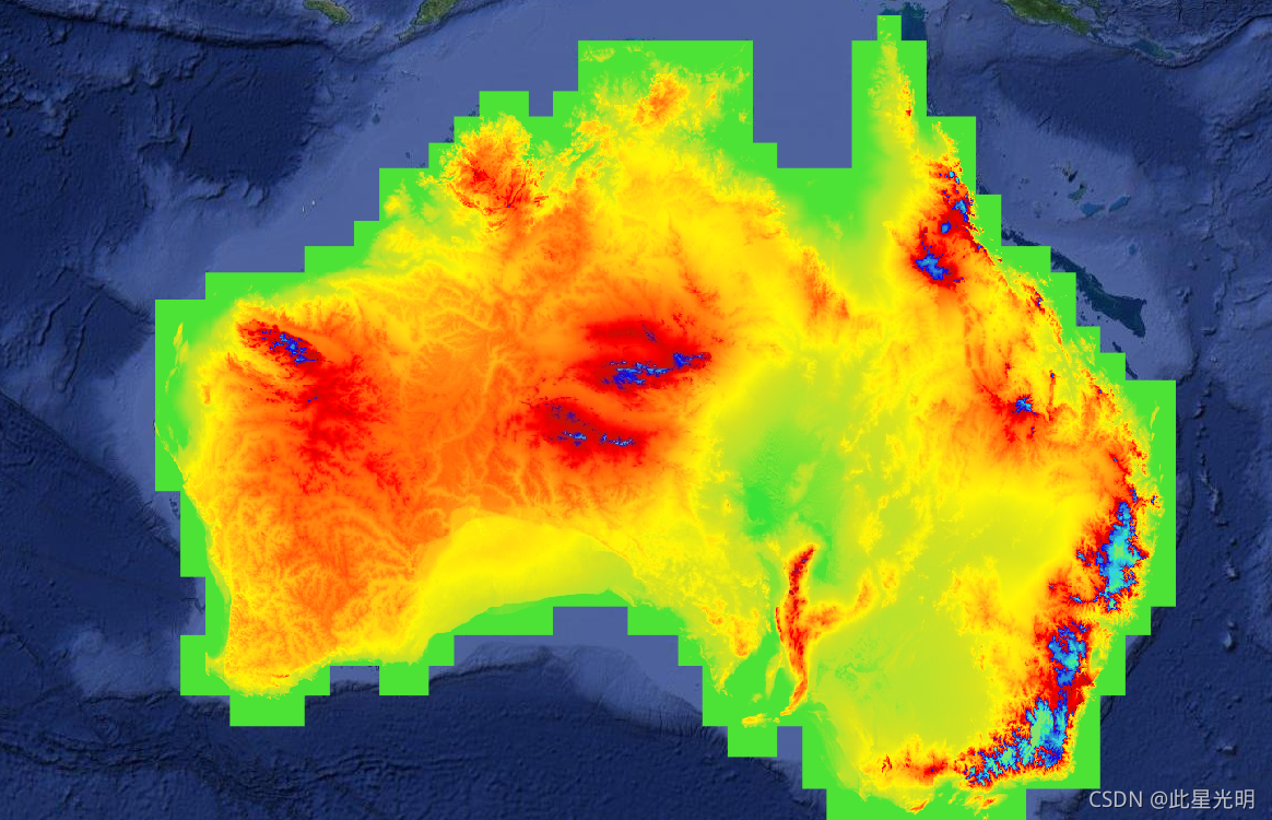
Google Earth Engine ——数据全解析专辑(DEM-S: Australian Smoothed Digital Elevation Model)澳大利亚1弧秒 DEM!
The Smoothed Digital Elevation Model (DEM-S) was derived from the SRTM data acquired by NASA in February 2000. DEM-S represents ground surface topography (excluding vegetation features) and has been ....
Google Earth Engine ——数据全解析专辑(DEM-H: Australian SRTM Hydrologically Enforced Digital)澳大利亚1弧秒 DEM!
The Hydrologically Enforced Digital Elevation Model (DEM-H) was derived from the SRTM data acquired by NASA in February 2000. The model has been hydrologically conditioned and drainage enforced. The ....

Google Earth Engine ——数据全解析专辑(AHN Netherlands 0.5m DEM, Interpolated)荷兰0.5m 格网DEM!
The AHN DEM is a 0.5m DEM covering the Netherlands. It was generated from LIDAR data taken in the spring between 2007 and 2012.It contains ground level samples with all other items above ground (such....

Google Earth Engine ——数据全解析专辑(Canada AAFC Annual Crop Inventory)
Starting in 2009, the Earth Observation Team of the Science and Technology Branch (STB) at Agriculture and Agri-Food Canada (AAFC) began the process of generating annual crop type digital maps. Focus....

Google Earth Engine ——数据全解析专辑(AHN Netherlands 0.5m DEM, Interpolated)荷兰0.5m 点云平方逆距离加权方法DEM!
The AHN DEM is a 0.5m DEM covering the Netherlands. It was generated from LIDAR data taken in the spring between 2007 and 2012. This version contains both ground level samples and items above gr....

Google Earth Engine ——数据全解析专辑(ASTER L1T Radiance)
The Advanced Spaceborne Thermal Emission and Reflection Radiometer (ASTER) is a multispectral imager that was launched on board NASA's Terra spacecraft in December, 1999. ASTER can collect data in 14....

Google Earth Engine ——数据全解析专辑(Australian 5M DEM)澳大利亚5m DEM(局部)!
The Digital Elevation Model (DEM) 5 Metre Grid of Australia derived from LiDAR model represents a National 5 metre (bare earth) DEM which has been derived from some 236 individual LiDAR surveys betwe....

Google Earth Engine ——带缓冲的随机样本选择
地球引擎示例进行土地覆盖分类时的一个常见问题是采样数据中的空间自相关风险会扭曲预测结果或准确性评估。可以帮助解决此问题的一种方法是使用某种形式的缓冲确保训练和验证样本之间有足够的间隔。这个例子将演示一种方法来做到这一点。使用缓冲区生成随机样本的一种蛮力方法可能是获取大量样本,并通过丢弃近邻将这些样本过滤到较小的数字。然而,选择从哪些点开始可能具有挑战性,并且计算点之间距离的叉积可能很昂贵,因此这....
Google Earth Engine(GEE)—geemap天气、植被数据可视化时间序列分析
import ee import geemap # geemap.update_package()天气数据可视化Map = geemap.Map() collection = ee.ImageCollection('NOAA/GFS0P25') \ .filterDate('2018-12-22', '2018-12-23') \ .limit(24) \ .select('temp...
本页面内关键词为智能算法引擎基于机器学习所生成,如有任何问题,可在页面下方点击"联系我们"与我们沟通。
google engine相关内容
- google earth engine栅格
- google engine数据
- google earth engine下载
- google engine应用
- google engine模型
- google engine构建
- google engine生物量
- google earth engine遥感
- google engine地上
- google engine雷达数据
- google engine空气
- google earth engine地表温度
- google earth engine gee卫星数据
- google earth engine森林序列
- google engine雷达
- google engine气候数据
- google earth engine导出
- google engine导出
- google engine空间
- google earth engine values
- google engine gee火灾
- google engine组织
- google earth engine gee landsat
- google engine landsat8 ndvi
- google earth engine gee landsat8影像
- google engine ndvi
- google earth engine evi
- google engine特征
- google engine gee特征
- google engine计算
google更多engine相关
- google earth engine lst
- google earth engine地图
- google engine gee案例
- google earth engine地表
- google engine面积
- google earth engine影像
- google earth engine融合
- google engine地球
- google engine gee
- google earth engine gee contain
- google earth engine数据集
- google engine分辨率
- google engine影像
- google engine gee数据集
- google earth engine数据数据集
- google engine modis
- google earth engine图像
- google earth engine指数数据集
- google engine数据集分辨率
- google engine植被
- google engine分辨率数据集
- google earth engine土壤
- google earth engine global
- google engine数据集数据
- google earth engine归一化
- google engine dem
- google earth engine人口
- google engine分类
- google earth engine面积
- google earth engine陆地
google您可能感兴趣
- google代码
- google视频
- google python
- google架构
- google实战
- google模型
- google工具
- google搜索功能
- google策略
- google推理
- google earth
- google数据集
- google gee
- google数据
- google play
- google分辨率
- google chrome
- google应用
- google解析
- google开源
- google搜索
- google影像
- google ai
- google浏览器
- google分析
- google谷歌
- google网站
- google guava
- google地图
- google landsat