
Google Earth Engine——美国PRISM插值程序模拟了天气和气候如何随海拔变化,并考虑了海岸效应、温度反转和可能导致雨影的地形障碍。
The PRISM daily and monthly datasets are gridded climate datasets for the conterminous United States, produced by the PRISM Climate Group at Oregon State University. Grids are developed using PRISM (....

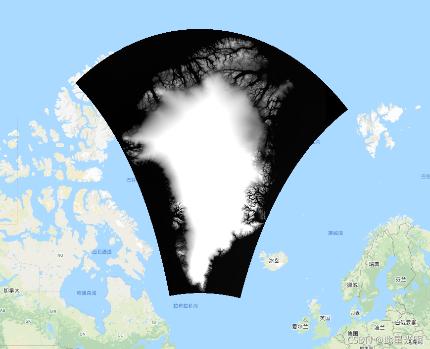
Google Earth Engine——该数据集为格陵兰岛冰原提供了15米的完整的陆地冰和海洋分类
This dataset provides complete land ice and ocean classification masks at 15 m for the Greenland ice sheet. Ice cover was mapped using a combination of orthorectified panchromatic (band 8) imagery fr....

Google Earth Engine—该数据集提供了格陵兰岛冰盖的完整的15米分辨率的图像,该图像来自1999年至2002年的Landsat 7 ETM+和RADARSAT-1 SAR图像
This dataset provides a complete 15 m resolution image mosaic of the Greenland ice sheet derived from Landsat 7 ETM+ and RADARSAT-1 SAR imagery from the years 1999 to 2002. The methods include a comb....

Google Earth Engine——该数字高程模型 (DEM) 由 ASTER 和 SPOT-5 DEM 的组合构建而成,用于冰盖外围和边缘(即平衡线高程以下)以南约 82.5°N,以及冰盖内部
This Digital Elevation Model (DEM) is constructed from a combination of ASTER and SPOT-5 DEM's for the ice sheet periphery and margin (i.e. below the equilbrium line elevation) south of approximately....
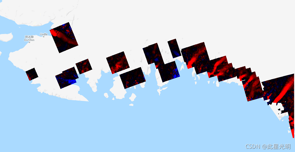
Google Earth Engine——该数据集是美国宇航局在研究环境中使用地球系统数据记录 (MEaSUREs) 计划的一部分,包括选定冰川出口区域的月平均速度图
This dataset, part of the NASA Making Earth System Data Records for Use in Research Environments (MEaSUREs) program, consists of mean monthly velocity maps for selected glacier outlet areas. The maps....
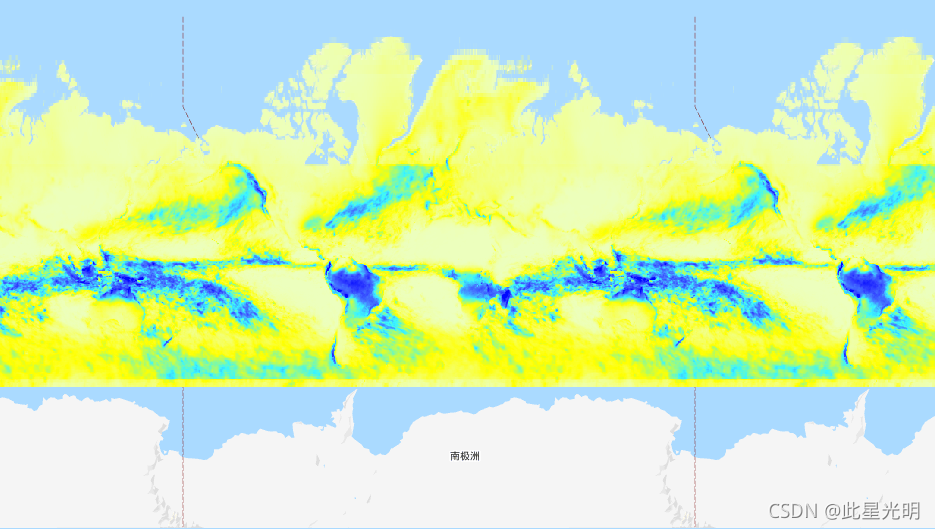
Google Earth Engine——基于2000-2017年时间序列的长期MODIS LST地表温度昼夜差1公里分辨率数据集
Long-term MODIS LST day-time and night-time differences at 1 km based on the 2000-2017 time seriesDerived using the data.table package and quantile function in R . For more info about the MODIS LST p....

Google Earth Engine——2000-2017年陆地表面温度日间月平均值。
Land Surface Temperature daytime monthly mean value 2000-2017.Derived using the data.table package and quantile function in R. For more info about the MODIS LST product see this page. Antartica is no....

Google Earth Engine——基于2000-2017年时间序列的长期MODIS LST昼夜温差标准偏差,在1公里分辨率。
Long-term MODIS LST day-time and night-time temperatures standard deviation at 1 km based on the 2000-2017 time series.Derived using the data.table package and quantile function in R. For more info a....

Google Earth Engine——基于SM2RAIN-ASCAT 2007-2018、IMERG、CHELSA Climate和WorldClim的1公里分辨率的月降水量,单位是毫米。
Monthly precipitation in mm at 1 km resolution based on SM2RAIN-ASCAT 2007-2018, IMERG, CHELSA Climate, and WorldClim.Downscaled to 1 km resolution using gdalwarp (cubic splines) and an average betwe....
Google Earth Engine——潜在的自然植被生物群落的全球预测类别(基于使用BIOMES 6000数据集的 “当前生物群落 “类别的预测。
Potential Natural Vegetation biomes global predictions of classes (based on predictions using the BIOMES 6000 dataset's 'current biomes' category.)Potential Natural Vegetation (PNV) is the vegetation....

本页面内关键词为智能算法引擎基于机器学习所生成,如有任何问题,可在页面下方点击"联系我们"与我们沟通。
google engine相关内容
- google earth engine栅格
- google engine数据
- google earth engine下载
- google engine应用
- google engine模型
- google engine构建
- google engine生物量
- google earth engine遥感
- google engine地上
- google engine雷达数据
- google engine空气
- google earth engine地表温度
- google earth engine gee卫星数据
- google earth engine森林序列
- google engine雷达
- google engine气候数据
- google earth engine导出
- google engine导出
- google engine空间
- google earth engine values
- google engine gee火灾
- google engine组织
- google earth engine gee landsat
- google engine landsat8 ndvi
- google earth engine gee landsat8影像
- google engine ndvi
- google earth engine evi
- google engine特征
- google engine gee特征
- google engine计算
google更多engine相关
- google earth engine lst
- google earth engine地图
- google engine gee案例
- google earth engine地表
- google engine面积
- google earth engine影像
- google earth engine融合
- google engine地球
- google engine gee
- google earth engine gee contain
- google earth engine数据集
- google engine分辨率
- google engine影像
- google engine gee数据集
- google earth engine数据数据集
- google engine modis
- google earth engine图像
- google earth engine指数数据集
- google engine数据集分辨率
- google engine植被
- google engine分辨率数据集
- google earth engine土壤
- google earth engine global
- google engine数据集数据
- google earth engine归一化
- google engine dem
- google earth engine人口
- google engine分类
- google earth engine面积
- google earth engine陆地
google您可能感兴趣
- google区别
- google seo
- google分析
- google抓取
- google search
- google代码
- google视频
- google python
- google架构
- google实战
- google earth
- google数据集
- google gee
- google数据
- google play
- google分辨率
- google chrome
- google应用
- google解析
- google开源
- google搜索
- google影像
- google ai
- google浏览器
- google谷歌
- google网站
- google guava
- google地图
- google landsat
- google工具
