
Google Earth Engine ——MODIS/006/MYD09GQ表面反射率产品提供了在没有大气散射或吸收的情况下在地面测量的表面光谱反射率的估计。低层数据经过大气气体和气溶胶的校正。
The MODIS Surface Reflectance products provide an estimate of the surface spectral reflectance as it would be measured at ground level in the absence of atmospheric scattering or absorption. Low-leve....

Google Earth Engine ——MYD09GA.006 Aqua 地表反射率 Daily Global 1km and 500m在没有大气散射或吸收的情况下在地
The MODIS Surface Reflectance products provide an estimate of the surface spectral reflectance as it would be measured at ground level in the absence of atmospheric scattering or absorption. Low-leve....

Google Earth Engine ——MYD09A1.006 Aqua Surface Reflectance 8-DayAqua MODIS 1-7带500米分辨率
The MYD09A1 V6 product provides an estimate of the surface spectral reflectance of Aqua MODIS bands 1-7 at 500m resolution and corrected for atmospheric conditions such as gasses, aerosols, and Rayle....

Google Earth Engine ——MOD08_M3 V6是一个大气全球产品,包含每月1×1度网格的大气参数平均值。这些参数与大气气溶胶颗粒特性、臭氧总负荷、大气水汽、云的光学和物理特性
MOD08_M3 V6 is an atmosphere global product that contains monthly 1 x 1 degree grid average values of atmospheric parameters. These parameters are related to atmospheric aerosol particle properties, ....

Google Earth Engine ——MODOCGA V6海洋反射率产品由Terra MODIS 8-16波段的1公里反射率数据1km
The MODOCGA V6 ocean reflectance product consists of 1 kilometer reflectance data from Terra MODIS bands 8-16. The product is referred to as ocean reflectance, because bands 8-16 are used primarily t....

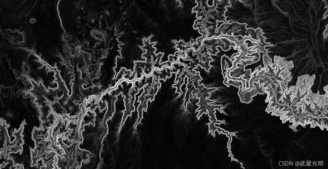
Google Earth Engine——GTOPO30: Global 30 Arc-Second Elevation全球数字高程模型(DEM),水平网格间距为30角秒(约1公里)。
GTOPO30: Global 30 Arc-Second ElevationGTOPO30 is a global digital elevation model (DEM) with a horizontal grid spacing of 30 arc seconds (approximately 1 kilometer). The DEM was derived from several....

Google Earth Engine——USGS/LIMA/MOSAIC南极洲大地卫星图像镶嵌(LIMA)是一个无缝的、几乎无云的数据,由经过处理的大地卫星7 ETM+场景创建。
Landsat Image Mosaic of Antarctica (LIMA) 16-Bit Pan-Sharpened MosaicThe Landsat Image Mosaic of Antarctica (LIMA) is a seamless and virtually cloudless mosaic created from processed Landsat 7 ETM+ s....
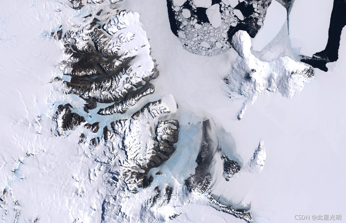
Google Earth Engine——南极洲大地卫星地表反射率SR高清图像
Landsat Image Mosaic of Antarctica (LIMA) - Processed Landsat Scenes (16 bit)The Landsat Image Mosaic of Antarctica (LIMA) is a seamless and virtually cloudless mosaic created from processed Landsat ....

Google Earth Engine——USGS National Elevation Dataset 国家高程数据集(NED)曾经是*美国地质调查局的主要高程数据产品。NED是一个无缝数据集
USGS National Elevation Dataset 1/3 Arc-SecondThe National Elevation Dataset (NED) used to be* the primary elevation data product of the USGS. The NED is a seamless dataset with the best available ra....

Google Earth Engine——SRTM V3产品(SRTM Plus)由NASA JPL提供,分辨率为1弧秒(约30米)。
The Shuttle Radar Topography Mission (SRTM, see Farr et al. 2007) digital elevation data is an international research effort that obtained digital elevation models on a near-global scale. This SRTM V....
本页面内关键词为智能算法引擎基于机器学习所生成,如有任何问题,可在页面下方点击"联系我们"与我们沟通。
google engine相关内容
- google earth engine栅格
- google engine数据
- google earth engine下载
- google engine应用
- google engine模型
- google engine构建
- google engine生物量
- google earth engine遥感
- google engine地上
- google engine雷达数据
- google engine空气
- google earth engine地表温度
- google earth engine gee卫星数据
- google earth engine森林序列
- google engine雷达
- google engine气候数据
- google earth engine导出
- google engine导出
- google engine空间
- google earth engine values
- google engine gee火灾
- google engine组织
- google earth engine gee landsat
- google engine landsat8 ndvi
- google earth engine gee landsat8影像
- google engine ndvi
- google earth engine evi
- google engine特征
- google engine gee特征
- google engine计算
google更多engine相关
- google earth engine lst
- google earth engine地图
- google engine gee案例
- google earth engine地表
- google engine面积
- google earth engine影像
- google earth engine融合
- google engine地球
- google engine gee
- google earth engine gee contain
- google earth engine数据集
- google engine分辨率
- google engine影像
- google engine gee数据集
- google earth engine数据数据集
- google engine modis
- google earth engine图像
- google earth engine指数数据集
- google engine数据集分辨率
- google engine植被
- google engine分辨率数据集
- google earth engine土壤
- google earth engine global
- google engine数据集数据
- google earth engine归一化
- google engine dem
- google earth engine人口
- google engine分类
- google earth engine面积
- google earth engine陆地
google您可能感兴趣
- google区别
- google seo
- google分析
- google抓取
- google search
- google代码
- google视频
- google python
- google架构
- google实战
- google earth
- google数据集
- google gee
- google数据
- google play
- google分辨率
- google chrome
- google应用
- google解析
- google开源
- google搜索
- google影像
- google ai
- google浏览器
- google谷歌
- google网站
- google guava
- google地图
- google landsat
- google工具
