
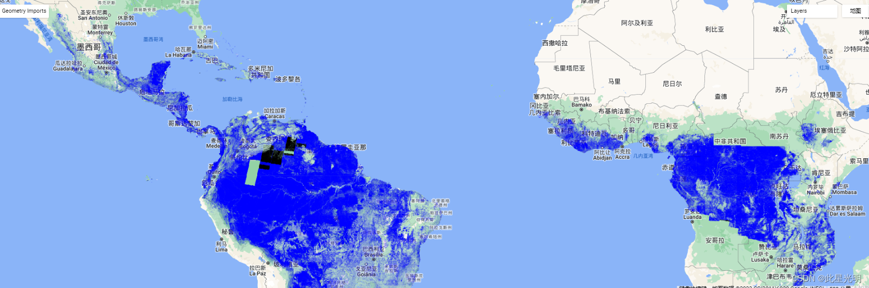
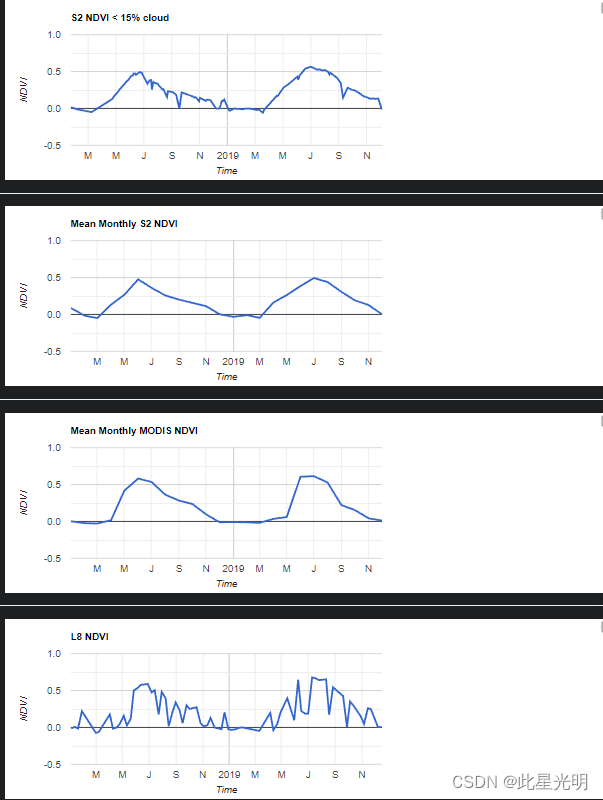
Google Earth Engine(GEE)——Landsat8/modis/sentinel2 NDVI时序影像差异对比分析图表
很多时候我们只管使用数据,而不知道数据之间的差异在那里,所以我们可以选择相同的点然后加载不同的数据集,然后查看某个点的时序影像来实现影像差异对比。 Landsat 8是由美国地质调查局(USGS)运行的陆地观测卫星,于2013年发射。它具有高分辨率的传感器(OLI和TIRS),可捕捉可见光、红外线和热红外线波段的数据,为地球科学家、资源管理人员和环境监测人员提供了有价值的信息。 Land...
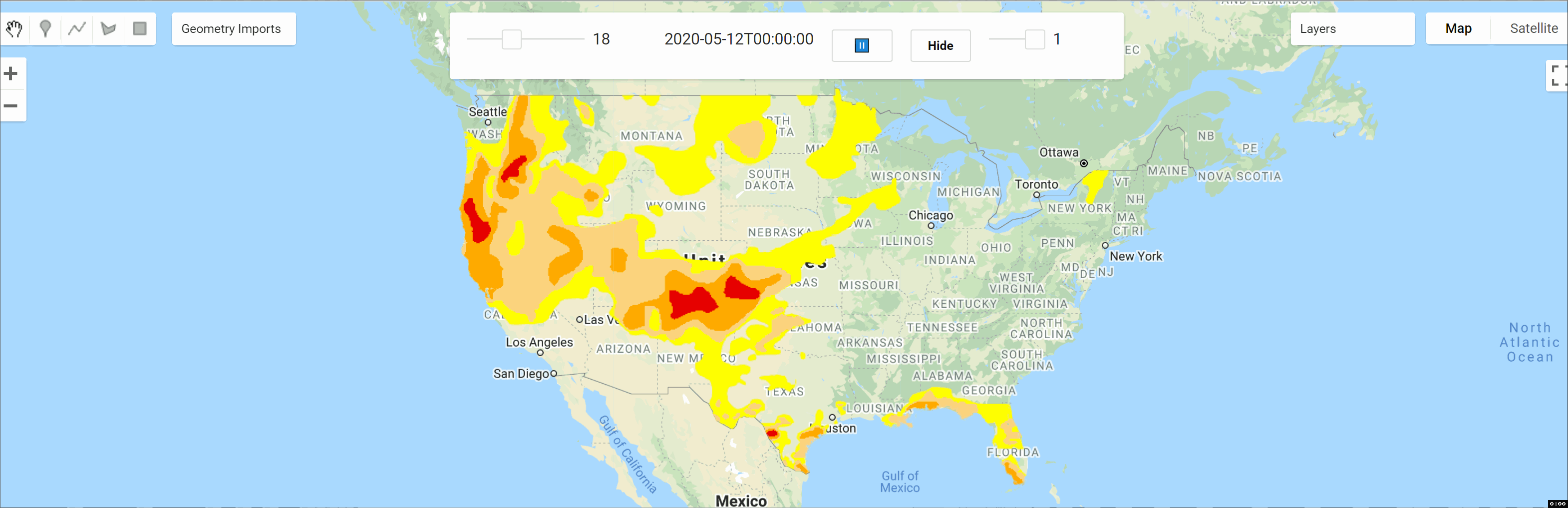
Google Earth Engine(GEE)——美国干旱监测数据集
美国干旱监测 美国干旱监测是每周四发布的地图,显示美国部分地区处于干旱状态。该地图使用五个分类:异常干燥(D0),显示可能进入或正在走出干旱的地区,以及四个级别的干旱:中度(D1),严重(D2),极端(D3)和特殊(D4)。前言 – 床长人工智能教程 自1999年成立以来,干旱监测一直是一个团队的努力,由内布拉斯加大学林肯分校的国家干旱缓解中心(NDMC)、国家海洋和大气管理局(...
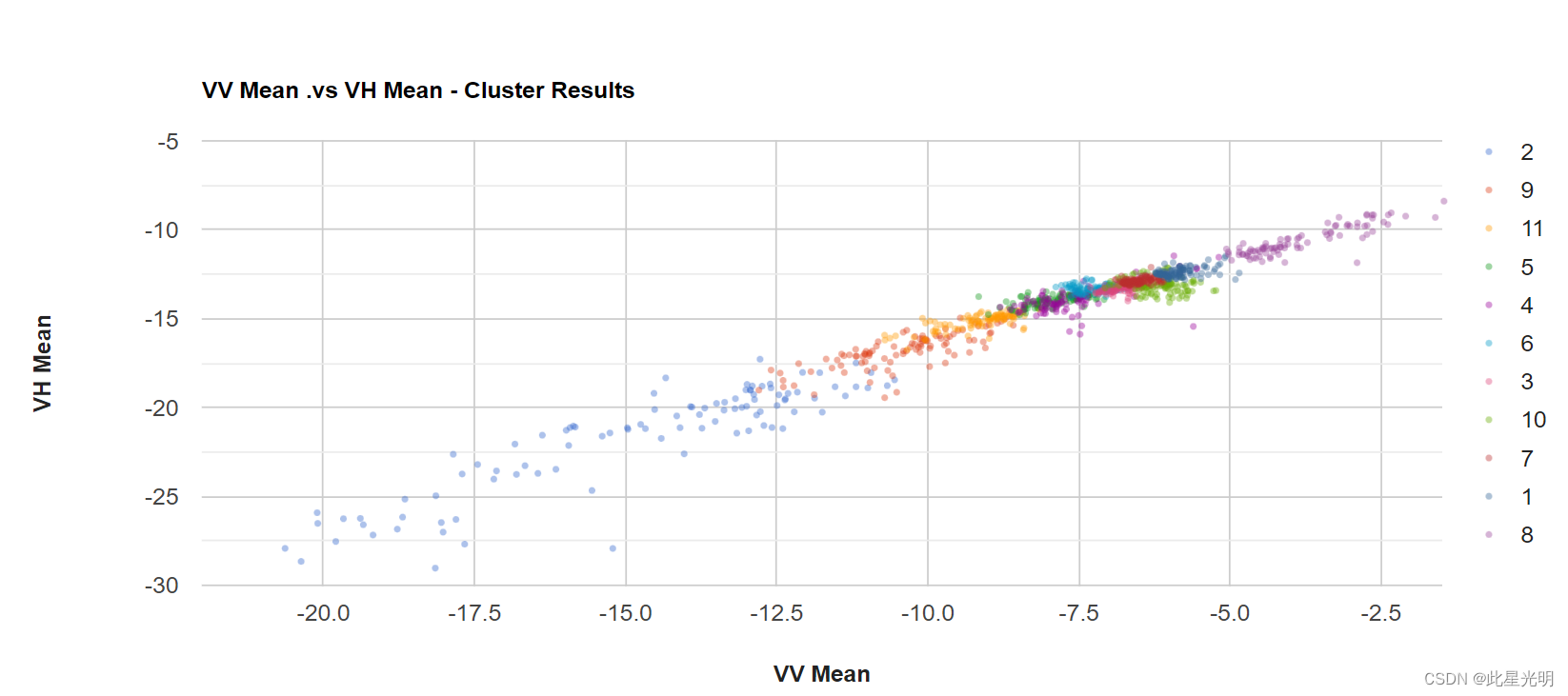
Google Earth Engine(GEE)——加载的图表图例无法
我正在使用功能组图——散点图。图表上显示的图例(系列)会自动按照首次出现的值排序,因此它看起来像一个随机数(附图)。我想通过从小到大对值进行排序来自定义图例,但一无所获(案例:1 - 11)。有没有人有办法解决吗? 原始代码: var target_image = ee.Ima...
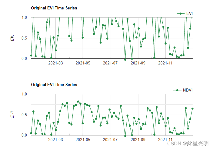
Google Earth Engine(GEE)——如何进行NDVI和EVI指数的图表展示?
我们如何进行NDVI和EVI指数的图表展示,我们可以通过建立一个函数NDVI和EVI,然后用map遍历每一期影像,从而实现图表的展示,这我们使用sentinel2影像进行分析。 Sentinel-2卫星是由欧洲空间局(ESA)和欧洲联盟开发的一个卫星系统,它可以提供高分辨率和高质量的地球观测数据,特别是在多光谱图像方面。 以下是Sentinel-2卫星影像的相关信息: ...
Google Earth Engine(GEE)——提取指定矢量集合中的NDVI值并附时间属性
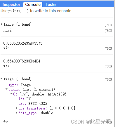
本教程的主要目的是实现影像转化为数组,然后我们需要直到其转化为的数组的轴,然后根据轴的信息进行切片,切片后完成时间属性的标准转化,这里一定要对影像结果提取完成后再对矢量集合进行操作,最后就可以提取指定的属性信息。 阵列排序对于获得自定义质量的马赛克非常有用,这涉及到根据不同波段的值reduce图像波段的子集。下面的例子按NDVI排序,然后得到集合中NDVI值最高的观测值子集的值: ...
Google Earth Engine(GEE)——ndvi.gt is not a function
你好, 我试图通过屏蔽值的上下 10 个百分位数来消除计算出的 NDVI 数据集中的异常值,但我在第 398 行中不断收到错误消息,显示第 398 行: ndvi.gt不是函数。 我怎样才能解决这个问题? 代码链接: https://code.earthengine.google.com/f5a139f1c30df78322e7136c63c42e2e 原始代码...
Google Earth Engine(GEE)——用填充后的Landsat7影像进行LST地表温度计算(C值转化为K值)
很多时候我们在长时间序列的研究中会忽略使用Landsat7 因为充满条带,而且在使用的时候我们因为需要填充,所以比较麻烦,但是我们今天使用一个填充函数来快速实现后,然后进行下一步ndvi和LST的计算。 函数:这里影像填充...
Google Earth Engine(GEE)——Segmentation.seedGrid和SNIC (Simple Non-Iterative Clustering)案例和错误缺少特征错误分析
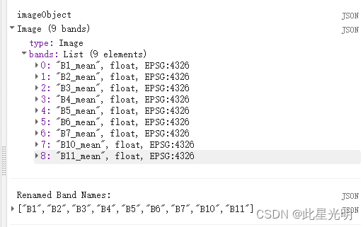
问题: 混淆矩阵(错误) Collection.errorMatrix:缺少特征“1_1_1_1_1_1_2_0”的属性“B1_mean”。 ConfusionMatrix (Error) Collection.loadTable: Collection asset 'projects/ee-priyanka/assets/Imphal_v...
Google Earth Engine(GEE)——求指定区域的NDVI时序变化和不同值域范围内的像素数量及其面积
本程序原理很简单,主要就是选定指定的研究区进行NDVI6-8年的时序分析,并求出指定时序范围内的的值。当然再计算每月的过程中,我们肯定会用到map循环遍历每一年月份的图表,通过使用linearfit来计算斜率,通过选择指定阈值范围内的斜率来计算不同范围内的像素值。这里可以差异化加载不同阈值范围内的影像,也就是分段表示不同颜色。 这里再设定图表的时候,我们因为时间时默认的所以我们这里可以通...
本页面内关键词为智能算法引擎基于机器学习所生成,如有任何问题,可在页面下方点击"联系我们"与我们沟通。
google engine相关内容
- google earth engine栅格
- google engine数据
- google earth engine下载
- google engine应用
- google engine模型
- google engine构建
- google engine生物量
- google earth engine遥感
- google engine地上
- google engine雷达数据
- google engine空气
- google earth engine地表温度
- google earth engine gee卫星数据
- google earth engine森林序列
- google engine雷达
- google engine气候数据
- google earth engine导出
- google engine导出
- google engine空间
- google earth engine values
- google engine gee火灾
- google engine组织
- google earth engine gee landsat
- google engine landsat8 ndvi
- google earth engine gee landsat8影像
- google engine ndvi
- google earth engine evi
- google engine特征
- google engine gee特征
- google engine计算
google更多engine相关
- google earth engine lst
- google earth engine地图
- google engine gee案例
- google earth engine地表
- google engine面积
- google earth engine影像
- google earth engine融合
- google engine地球
- google engine gee
- google earth engine gee contain
- google earth engine数据集
- google engine分辨率
- google engine影像
- google engine gee数据集
- google earth engine数据数据集
- google engine modis
- google earth engine图像
- google earth engine指数数据集
- google engine数据集分辨率
- google engine植被
- google engine分辨率数据集
- google earth engine土壤
- google earth engine global
- google engine数据集数据
- google earth engine归一化
- google engine dem
- google earth engine人口
- google engine分类
- google earth engine面积
- google earth engine陆地
google您可能感兴趣
- google代码
- google视频
- google python
- google架构
- google实战
- google模型
- google工具
- google搜索功能
- google策略
- google推理
- google earth
- google数据集
- google gee
- google数据
- google play
- google分辨率
- google chrome
- google应用
- google解析
- google开源
- google搜索
- google影像
- google ai
- google浏览器
- google分析
- google谷歌
- google网站
- google guava
- google地图
- google landsat
