
Google Earth Engine——NASA NEX-GDDP数据集由全球降尺度气候情景NEX-GDDP: NASA Earth Exchange Global Daily Downscaled
The NASA NEX-GDDP dataset is comprised of downscaled climate scenarios for the globe that are derived from the General Circulation Model (GCM) runs conducted under the Coupled Model Intercomparison P....

Google Earth Engine——陆地数据同化系统(LDAS)结合多种来源的观测数据(如降水表数据、卫星数据和雷达降水测量)
Land Data Assimilation System (LDAS) combines multiple sources of observations (such as precipitation gauge data, satellite data, and radar precipitation measurements) to produce estimates of climato....

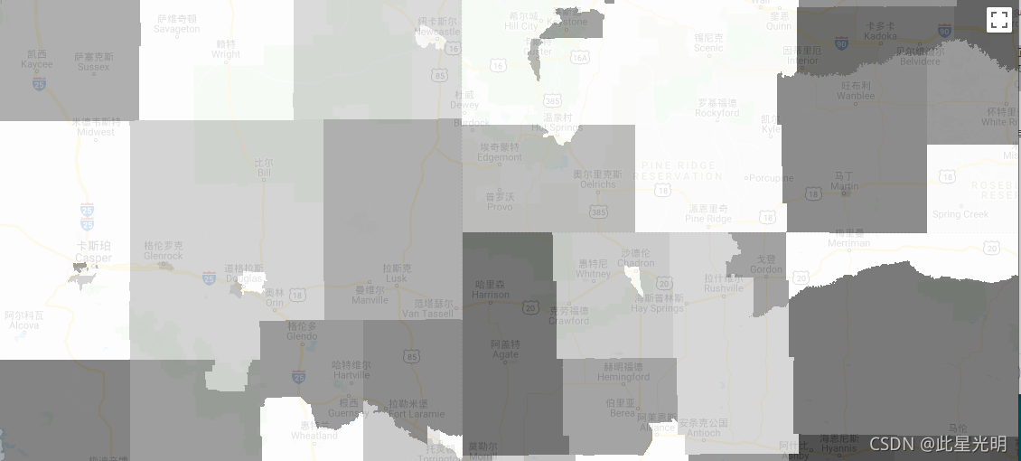
Google Earth Engine——美国人口普查局定期发布一个名为TIGER的地理数据库。这个表格包含了2010年人口普查的人口概况1的数值,按普查区汇总
The United States Census Bureau regularly releases a geodatabase named TIGER. This table contains the 2010 census Demographic Profile 1 values aggregated by census tract. Tract areas vary tremendousl....
Google Earth Engine——300米的空间分辨率提供了2010年地面和地下生物质碳密度的时间一致性和统一的全球地图,地面生物量地图整合了针对土地覆盖的木质、草原、耕地和苔原生物量的遥感
This dataset provides temporally consistent and harmonized global maps of aboveground and belowground biomass carbon density for the year 2010 at a 300-m spatial resolution. The aboveground biomass m....

Google Earth Engine——真彩色数据集Planet labs Inc. SkySat卫星在2015年为实验性的 “Skybox for Good Beta “项目,以及各种危机应对事件
This data from Planet labs Inc. SkySat satellites was collected for the experimental "Skybox for Good Beta" program in 2015, as well as for various crisis response events and a few other projects. Th....
Google Earth Engine——加拿大数字高程模型(CDEM)是加拿大自然资源部(NRCan)测高系统的一部分,源于现有的加拿大数字高程数据(CDED)
The Canadian Digital Elevation Model (CDEM) is part of Natural Resources Canada's (NRCan) altimetry system and stems from the existing Canadian Digital Elevation Data (CDED). In these data, elevation....

Google Earth Engine——TERN/AET/CMRSET_LANDSAT_V2_1数据集使用CMRSET算法为澳大利亚提供准确的实际蒸散量(AET或ETa)
This dataset provides accurate actual evapotranspiration (AET or ETa) for Australia using the CMRSET algorithm. The AET band (named 'ETa') contains the average daily value from the CMRSET model for a....

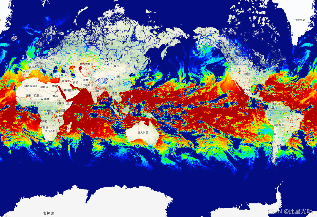
Google Earth Engine——AVHRR探路者5.3版海面温度数据集(PFV53)是由NOAA国家海洋学数据中心和迈阿密大学罗森斯蒂尔海洋与大气科学学院合作制作的全球每日两次的4公里数据
The AVHRR Pathfinder Version 5.3 Sea Surface Temperature dataset (PFV53) is a collection of global, twice-daily 4km sea surface temperature data produced in a partnership by the NOAA National Oceanog....
Google Earth Engine(GEE)——sentinel2数据介绍
之前有粉丝在公众号问我,对于sentinel2是否需要进行去云的问题,这里就简单写一下关于这个数据的问题:现在回答是因为所有光学影像都是需要去云的,因为遇到没有云的影像概率太小了,况且数据预处理阶段的去云是必不可少的一个关键环节,一般在GEE平台需要的处理就是去云处理,而很多modis数据和Landsat8数据,以及sentinel数据都是通过QA波段的位掩技术实现的。所以一般无论做反演还是监测....

Google Earth Engine——PRISM日数据集和月数据集是美国本土的网格化气候数据集,由俄勒冈州立大学的PRISM气候小组制作。网格是使用PRISM(独立坡度模型的参数-海拔回归)开发的
The PRISM daily and monthly datasets are gridded climate datasets for the conterminous United States, produced by the PRISM Climate Group at Oregon State University. Grids are developed using PRISM (....

本页面内关键词为智能算法引擎基于机器学习所生成,如有任何问题,可在页面下方点击"联系我们"与我们沟通。
google engine相关内容
- google earth engine栅格
- google engine数据
- google earth engine下载
- google engine应用
- google engine模型
- google engine构建
- google engine生物量
- google earth engine遥感
- google engine地上
- google engine雷达数据
- google engine空气
- google earth engine地表温度
- google earth engine gee卫星数据
- google earth engine森林序列
- google engine雷达
- google engine气候数据
- google earth engine导出
- google engine导出
- google engine空间
- google earth engine values
- google engine gee火灾
- google engine组织
- google earth engine gee landsat
- google engine landsat8 ndvi
- google earth engine gee landsat8影像
- google engine ndvi
- google earth engine evi
- google engine特征
- google engine gee特征
- google engine计算
google更多engine相关
- google earth engine lst
- google earth engine地图
- google engine gee案例
- google earth engine地表
- google engine面积
- google earth engine影像
- google earth engine融合
- google engine地球
- google engine gee
- google earth engine gee contain
- google earth engine数据集
- google engine分辨率
- google engine影像
- google engine gee数据集
- google earth engine数据数据集
- google engine modis
- google earth engine图像
- google earth engine指数数据集
- google engine数据集分辨率
- google engine植被
- google engine分辨率数据集
- google earth engine土壤
- google earth engine global
- google engine数据集数据
- google earth engine归一化
- google engine dem
- google earth engine人口
- google engine分类
- google earth engine面积
- google earth engine陆地
google您可能感兴趣
- google区别
- google seo
- google分析
- google抓取
- google search
- google代码
- google视频
- google python
- google架构
- google实战
- google earth
- google数据集
- google gee
- google数据
- google play
- google分辨率
- google chrome
- google应用
- google解析
- google开源
- google搜索
- google影像
- google ai
- google浏览器
- google谷歌
- google网站
- google guava
- google地图
- google landsat
- google工具