
Google Earth Engine——南极洲高程模型(REMA)2米和8米的空间分辨率数据集
镶嵌后REMA数据The Reference Elevation Model of Antarctica (REMA) is a high resolution, time-stamped Digital Surface Model (DSM) of Antarctica at 2-meter and 8-meter spatial resolutions.Mosaicked DEM files....

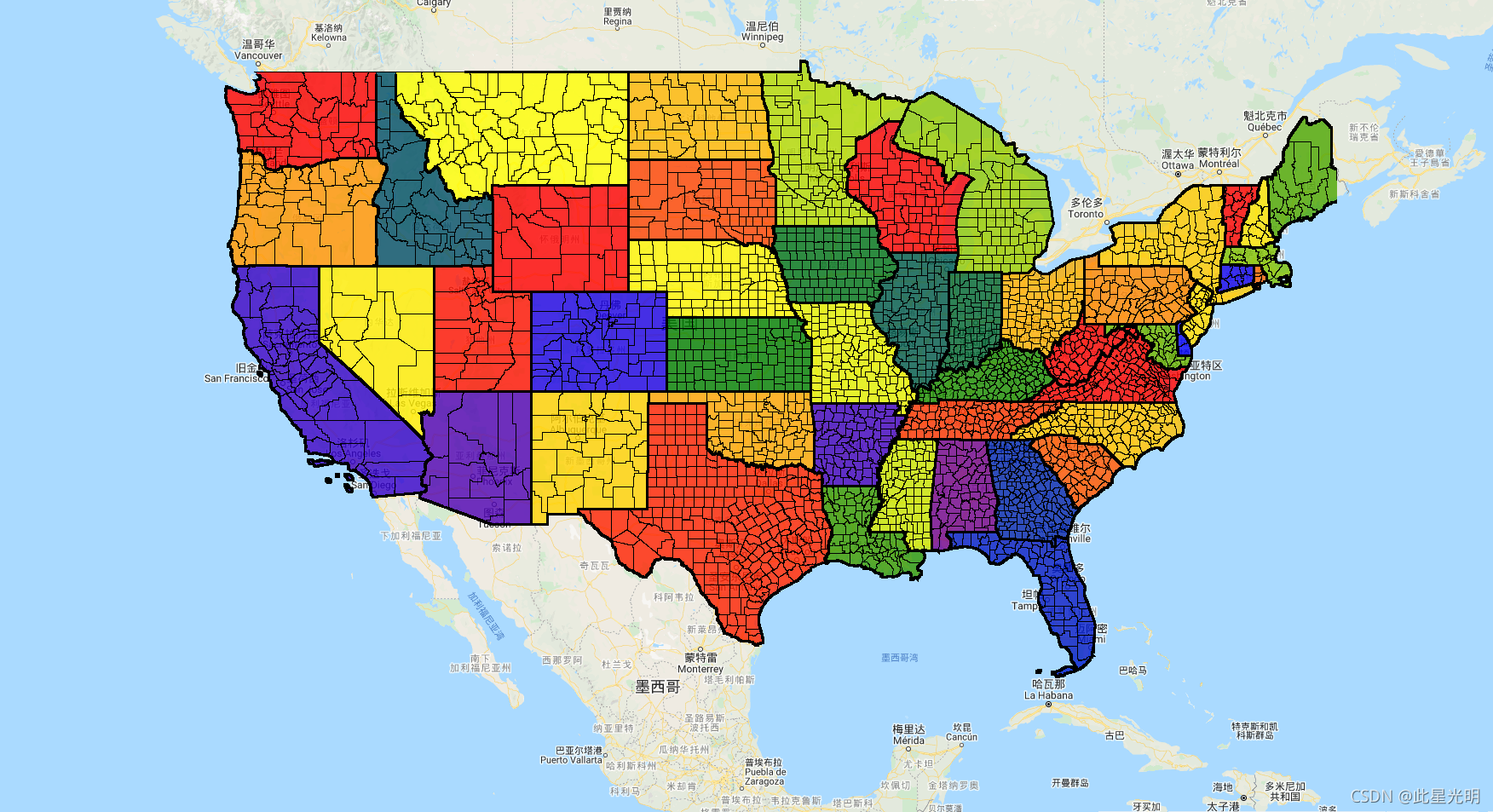
Google Earth Engine——美国人口普查局的TIGER数据集包含美国各州主要法律部门的2016年边界
The United States Census Bureau TIGER dataset contains the 2016 boundaries for primary legal divisions of US states. In most states, these entities are termed "counties". In Louisiana, these division....
Google Earth Engine——GOES-16/17 MCMIPC Series ABI Level 2 云层和水分图像产品的分辨率都是2公里数据集
GOES satellites are geostationary weather satellites run by NOAA. The Cloud and Moisture Imagery products are all at 2km resolution. Bands 1-6 are reflective. The dimensionless "reflectance factor" q....

Google Earth Engine——GFS全球天气预报模型数据集:384小时的预测,预测间隔为3小时,以6小时的时间分辨率进行(每天更新4次)
The Global Forecast System (GFS) is a weather forecast model produced by the National Centers for Environmental Prediction (NCEP). The GFS dataset consists of selected model outputs (described below)....
Google Earth Engine——NOAA/DMSP-OLS/NIGHTTIME_LIGHTS,DMSP数据由美国空军气象局收集
The Defense Meteorological Program (DMSP) Operational Line-Scan System (OLS) has a unique capability to detect visible and near-infrared (VNIR) emission sources at night.Version 4 of the DMSP-OLS Nig....

Google Earth Engine(GEE)——NOAA CDR GRIDSAT-B1数据集介绍(静止卫星的全球红外测量的高质量气候数据)
This dataset provides a high quality Climate Data Record (CDR) of global infrared measurements from geostationary satellites.The geostationary satellite data (GridSat-B1) provides data from 3 channel....

Google Earth Engine(GEE)——NASA-USDA增强型SMAP全球土壤水分数据以10公里的空间分辨率提供全球的土壤水分信息
NASA-USDA增强型SMAP全球土壤水分数据以10公里的空间分辨率提供全球的土壤水分信息。该数据集包括:地表和地下土壤湿度(毫米),土壤湿度剖面(%),地表和地下土壤湿度异常(-)。该数据集是通过使用一维集合卡尔曼滤波(EnKF)数据同化方法,将卫星派生的土壤水分主动被动(SMAP)3级土壤水分观测数据整合到修正的两层Palmer模型中而产生的。土壤水分异常是根据相关日期的气候学计算出来的。....

Google Earth Engine——NOAA/GOES/16/和17/MCMIPF地球静止气象卫星云层和水分图像产品的(分辨率都是2公里)
satellites are geostationary weather satellites run by NOAA.The Cloud and Moisture Imagery products are all at 2km resolution. Bands 1-6 are reflective. The dimensionless "reflectance factor" quantit....

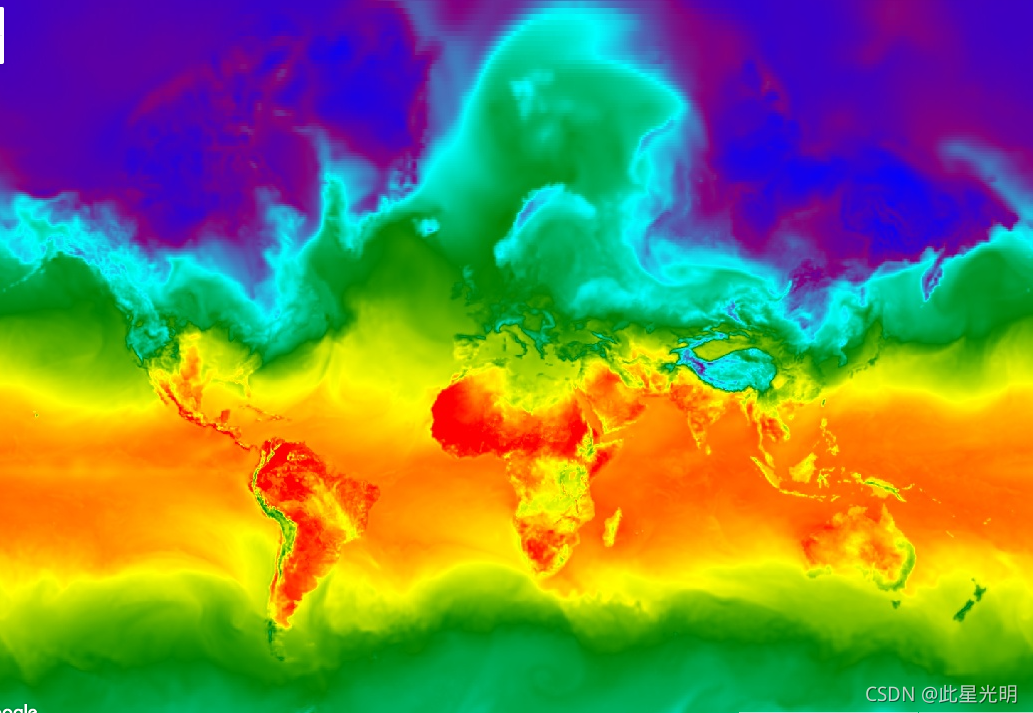
Google Earth Engine——EOSDIS下产生或收集的海洋颜色和卫星海洋生物数据
This level 3 product includes ocean color and satellite ocean biology data produced or collected under EOSDIS.This dataset may be used for studying the biology and hydrology of coastal zones, changes....

Google Earth Engine——美国国家环境预测中心(NCEP)的气候预测系统再分析(CFSR)是作为一个全球性的、高分辨率的、大气-海洋-陆地表面-海冰耦合系统设计和执行的数据集
The National Centers for Environmental Prediction (NCEP) Climate Forecast System Reanalysis (CFSR) was designed and executed as a global, high-resolution, coupled atmosphere-ocean-land surface-sea ic....

本页面内关键词为智能算法引擎基于机器学习所生成,如有任何问题,可在页面下方点击"联系我们"与我们沟通。
google engine相关内容
- google earth engine栅格
- google engine数据
- google earth engine下载
- google engine应用
- google engine模型
- google engine构建
- google engine生物量
- google earth engine遥感
- google engine地上
- google engine雷达数据
- google engine空气
- google earth engine地表温度
- google earth engine gee卫星数据
- google earth engine森林序列
- google engine雷达
- google engine气候数据
- google earth engine导出
- google engine导出
- google engine空间
- google earth engine values
- google engine gee火灾
- google engine组织
- google earth engine gee landsat
- google engine landsat8 ndvi
- google earth engine gee landsat8影像
- google engine ndvi
- google earth engine evi
- google engine特征
- google engine gee特征
- google engine计算
google更多engine相关
- google earth engine lst
- google earth engine地图
- google engine gee案例
- google earth engine地表
- google engine面积
- google earth engine影像
- google earth engine融合
- google engine地球
- google engine gee
- google earth engine gee contain
- google earth engine数据集
- google engine分辨率
- google engine影像
- google engine gee数据集
- google earth engine数据数据集
- google engine modis
- google earth engine图像
- google earth engine指数数据集
- google engine数据集分辨率
- google engine植被
- google engine分辨率数据集
- google earth engine土壤
- google earth engine global
- google engine数据集数据
- google earth engine归一化
- google engine dem
- google earth engine人口
- google engine分类
- google earth engine面积
- google earth engine陆地
google您可能感兴趣
- google代码
- google视频
- google python
- google架构
- google实战
- google模型
- google工具
- google搜索功能
- google策略
- google推理
- google earth
- google数据集
- google gee
- google数据
- google play
- google分辨率
- google chrome
- google应用
- google解析
- google开源
- google搜索
- google影像
- google ai
- google浏览器
- google分析
- google谷歌
- google网站
- google guava
- google地图
- google landsat