
Google Earth Engine ——美国LANDIFRE火灾数据集LANDFIRE MFRI (Mean Fire Return Interval) v1.2.0数据集内包含多种数据要素
LANDFIRE (LF), Landscape Fire and Resource Management Planning Tools, is a shared program between the wildland fire management programs of the U.S. Department of Agriculture's Forest Service, U.S. De....

Google Earth Engine ——美国LANDIFRE火灾数据集LANDFIRE/Fire/PLS/v1_2_0数据集内包含多种数据要素
LANDFIRE (LF), Landscape Fire and Resource Management Planning Tools, is a shared program between the wildland fire management programs of the U.S. Department of Agriculture's Forest Service, U.S. De....

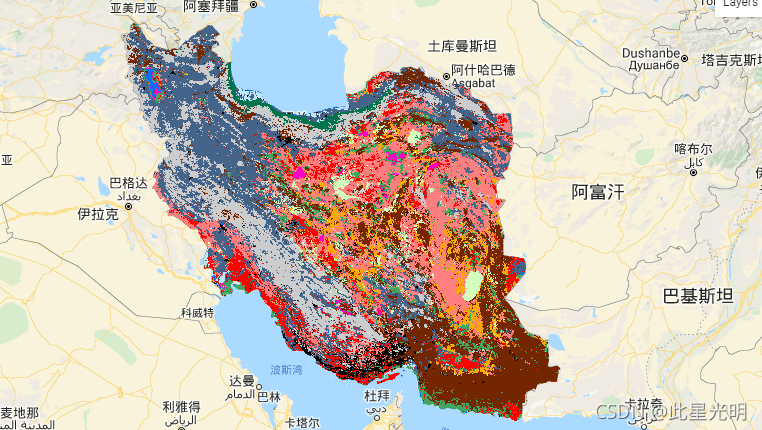
Google Earth Engine ——2017-2018年伊朗土地覆盖/土地利用数据集KNTU/LiDARLab/IranLandCover/V1
The Iran-wide land cover map was generated by processing Sentinel imagery within the Google Earth Engine Cloud platform. For this purpose, over 2,500 Sentinel-1 and over 11,000 Sentinel-2 images were....
Google Earth Engine ——美国LANDIFRE植被数据集包括。生物物理设置(BPS)环境场地潜力(ESP)现有植被冠层(EVC)现有植被高度(EVH)现有植被类型(EVT)数据集
Google Earth Engine ——美国LANDIFRE植被数据集包括。生物物理设置(BPS)环境场地潜力(ESP)现有植被冠层(EVC)现有植被高度(EVH)现有植被类型(EVT)数据集

Google Earth Engine ——ALOS World 3D - 30m (AW3D30) 是一个全球数字表面模型 (DSM) 数据集
ALOS World 3D - 30m (AW3D30) is a global digital surface model (DSM) dataset with a horizontal resolution of approximately 30 meters (1 arcsec mesh). The dataset is based on the DSM dataset (5-meter ....

Google Earth Engine ——2001-2017年非洲土壤深度 0-20 厘米和 20-50 厘米的可提取铁,预测平均值和标准偏差数据集
iSDAsoil Extractable IronExtractable iron at soil depths of 0-20 cm and 20-50 cm, predicted mean and standard deviation.Pixel values must be back-transformed with exp(x/10)-1.In areas of dense jungle....

Google Earth Engine ——2001-2017年使用坡度、化学和物理土壤特性得出的土壤肥力能力分类,预测平均值和标准偏差数据集
iSDAsoil Fertility Capability ClassificationSoil fertility capability classification derived using slope, chemical, and physical soil properties. For more information about this layer, please visit t....

Google Earth Engine ——2001-2017年非洲土壤深度 0-20 厘米和 20-50 厘米的可提取粘土含量,预测平均值和标准偏差数据集
Clay content at soil depths of 0-20 cm and 20-50 cm, predicted mean and standard deviation.In areas of dense jungle (generally over central Africa), model accuracy is low and therefore artefacts such....

Google Earth Engine ——2001-2017年非洲土壤深度 0-20 厘米和 20-50 厘米的可提取阳离子交换容量,预测平均值和标准偏差数据集
Effective Cation Exchange Capacity predicted mean and standard deviation at soil depths of 0-20 cm and 20-50 cm,Pixel values must be back-transformed with exp(x/10)-1.In areas of dense jungle (genera....

Google Earth Engine ——Gridded Surface Meteorological 数据集提供了 1979 年以来美国本土的温度、降水、风、湿度和辐射的高空间分辨率(~4 公里)
GRIDMET: University of Idaho Gridded Surface Meteorological DatasetThe Gridded Surface Meteorological dataset provides high spatial resolution (~4-km) daily surface fields of temperature, precipitati....

本页面内关键词为智能算法引擎基于机器学习所生成,如有任何问题,可在页面下方点击"联系我们"与我们沟通。
google engine相关内容
- google earth engine栅格
- google earth engine
- google engine数据
- google earth engine下载
- google engine应用
- google engine模型
- google engine构建
- google engine生物量
- google earth engine遥感
- google engine地上
- google engine雷达数据
- google engine空气
- google earth engine地表温度
- google earth engine gee卫星数据
- google earth engine森林序列
- google engine雷达
- google engine气候数据
- google earth engine导出
- google engine导出
- google engine空间
- google earth engine values
- google engine gee火灾
- google engine组织
- google earth engine gee landsat
- google engine landsat8 ndvi
- google earth engine gee landsat8影像
- google engine ndvi
- google earth engine evi
- google engine特征
- google engine gee特征
google更多engine相关
- google engine计算
- google earth engine lst
- google earth engine地图
- google engine gee案例
- google earth engine地表
- google engine面积
- google earth engine影像
- google earth engine融合
- google engine地球
- google engine gee
- google engine分辨率
- google engine影像
- google engine gee数据集
- google earth engine数据数据集
- google engine modis
- google earth engine图像
- google earth engine指数数据集
- google engine数据集分辨率
- google engine植被
- google engine分辨率数据集
- google earth engine土壤
- google earth engine global
- google engine数据集数据
- google earth engine归一化
- google engine dem
- google earth engine人口
- google engine分类
- google earth engine面积
- google earth engine陆地
- google engine归一化数据集
google您可能感兴趣
- google嵌入
- google雷达
- google光学
- google climate
- google卫星
- google deepmind
- google数据集
- google dem
- google 10m
- google区别
- google earth
- google gee
- google数据
- google play
- google分辨率
- google chrome
- google应用
- google解析
- google开源
- google搜索
- google影像
- google分析
- google ai
- google浏览器
- google谷歌
- google网站
- google guava
- google地图
- google landsat
- google工具
