Google Earth Engine——基于2000-2017年时间序列的长期MODIS LST地表温度昼夜差1公里分辨率数据集
Long-term MODIS LST day-time and night-time differences at 1 km based on the 2000-2017 time seriesDerived using the data.table package and quantile function in R . For more info about the MODIS LST p....

Google Earth Engine——潜在的自然植被生物群落的全球预测类别(基于使用BIOMES 6000数据集的 “当前生物群落 “类别的预测。
Potential Natural Vegetation biomes global predictions of classes (based on predictions using the BIOMES 6000 dataset's 'current biomes' category.)Potential Natural Vegetation (PNV) is the vegetation....

Google Earth Engine——全球土壤体积密度数据集在6个标准深度(0、10、30、60、100和200厘米)的土壤体积密度(细土)10 x kg / m3,分辨率250米。
Soil bulk density (fine earth) 10 x kg / m3 at 6 standard depths (0, 10, 30, 60, 100 and 200 cm) at 250 m resolution.Processing steps are described in detail here. Antartica is not included.To access....

Google Earth Engine——250米处美国农业部土壤分类的预测数据集
Predicted USDA soil great group probablities at 250mDistribution of the USDA soil great groups based on machine learning predictions from global compilation of soil profiles. To learn more about soil....

Google Earth Engine——全球土壤含沙量数据集:250米分辨率下6个标准深度(0、10、30、60、100和200厘米)的含沙量(%)(千克/千克)
Sand content in % (kg / kg) at 6 standard depths (0, 10, 30, 60, 100 and 200 cm) at 250 m resolutionBased on machine learning predictions from global compilation of soil profiles and samples. Process....

Google Earth Engine——全球土壤纹理数据集:250米处6个土壤深度(0、10、30、60、100和200厘米)的土壤纹理等级(美国农业部系统)。
Soil texture classes (USDA system) for 6 soil depths (0, 10, 30, 60, 100 and 200 cm) at 250 mDerived from predicted soil texture fractions using the soiltexture package in R. Processing steps are des....

Google Earth Engine——全球增强植被指数(EVI)产品的基础数据集是MODIS BRDF校正图像(MCD43B4)
The underlying dataset for this Enhanced Vegetation Index (EVI) product is MODIS BRDF-corrected imagery (MCD43B4), which was gap-filled using the approach outlined in Weiss et al. (2014) to eliminate....

Google Earth Engine——全球土地覆盖产品的基础数据集是MODIS年度土地覆盖产品(MCD12Q1)中的IGBP层
The underlying dataset for this landcover product is the IGBP layer found within the MODIS annual landcover product (MCD12Q1). This data was converted from its categorical format, which has a ≈500 me....

Google Earth Engine——全球地表温度日间产品的基础数据集是MODIS陆地表面温度数据(MOD11A2)
The underlying dataset for this daytime product is MODIS land surface temperature data (MOD11A2), which was gap-filled using the approach outlined in Weiss et al. (2014) to eliminate missing data cau....

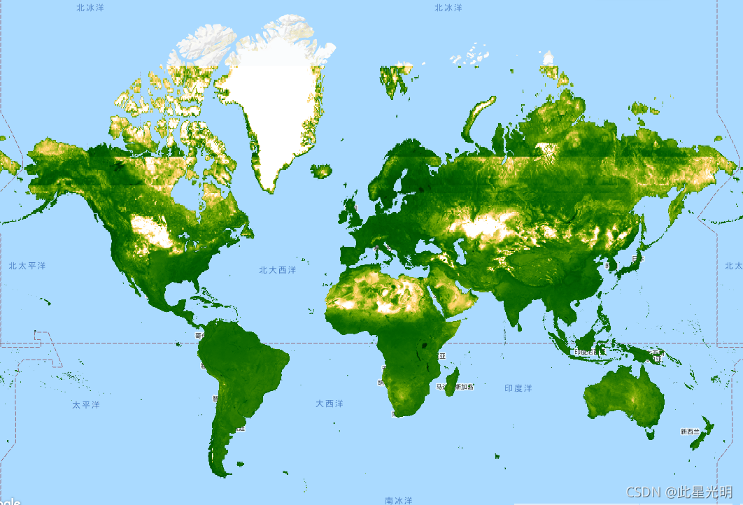
Google Earth Engine——流苏帽亮度(TCB)数据集该数据集由Malaria Atlas项目的Harry Gibson和Daniel Weiss制作
This gap-filled Tasseled Cap Brightness (TCB) dataset was created by applying the tasseled-cap equations defined in Lobser and Cohen (2007) to MODIS BRDF-corrected imagery (MCD43B4). The resulting da....

本页面内关键词为智能算法引擎基于机器学习所生成,如有任何问题,可在页面下方点击"联系我们"与我们沟通。
google engine相关内容
- google earth engine栅格
- google earth engine
- google engine数据
- google earth engine下载
- google engine应用
- google engine模型
- google engine构建
- google engine生物量
- google earth engine遥感
- google engine地上
- google engine雷达数据
- google engine空气
- google earth engine地表温度
- google earth engine gee卫星数据
- google earth engine森林序列
- google engine雷达
- google engine气候数据
- google earth engine导出
- google engine导出
- google engine空间
- google earth engine values
- google engine gee火灾
- google engine组织
- google earth engine gee landsat
- google engine landsat8 ndvi
- google earth engine gee landsat8影像
- google engine ndvi
- google earth engine evi
- google engine特征
- google engine gee特征
google更多engine相关
- google engine计算
- google earth engine lst
- google earth engine地图
- google engine gee案例
- google earth engine地表
- google engine面积
- google earth engine影像
- google earth engine融合
- google engine地球
- google engine gee
- google engine分辨率
- google engine影像
- google engine gee数据集
- google earth engine数据数据集
- google engine modis
- google earth engine图像
- google earth engine指数数据集
- google engine数据集分辨率
- google engine植被
- google engine分辨率数据集
- google earth engine土壤
- google earth engine global
- google engine数据集数据
- google earth engine归一化
- google engine dem
- google earth engine人口
- google engine分类
- google earth engine面积
- google earth engine陆地
- google engine归一化数据集
google您可能感兴趣
- google嵌入
- google雷达
- google光学
- google climate
- google卫星
- google deepmind
- google数据集
- google dem
- google 10m
- google区别
- google earth
- google gee
- google数据
- google play
- google分辨率
- google chrome
- google应用
- google解析
- google开源
- google搜索
- google影像
- google分析
- google ai
- google浏览器
- google谷歌
- google网站
- google guava
- google地图
- google landsat
- google工具

